- What is the Antonine Wall?
- Walking the Antonine Wall
- Roman sites to visit along the Wall (east to west)
- Museums to visit (east to west)
- Public art / Sculptures
- Roman-inspired murals and playparks
- Tourist attractions near the Wall
- Antonine Wall videos
- Podcasts / audio
- Maps
- Connect with us

What is the Antonine Wall?
The Antonine Wall is the northernmost frontier barrier of the Roman Empire in Britain, stretching across central Scotland. It was built around 142 AD during the reign of Emperor Antoninus Pius. The Wall marked the Roman Empire’s furthest incursion into Caledonia (modern-day Scotland).
It was constructed primarily from turf on a stone foundation and spanned roughly 37 miles (60 km) from Bo’ness on the Firth of Forth (east) to Old Kilpatrick on the River Clyde (west).
Today, it’s a part of the “Frontiers of the Roman Empire” UNESCO World Heritage Site, which also includes Hadrian’s Wall in northern England.
🔗 UNESCO World Heritage – Antonine Wall
🔗 Historic Environment Scotland – Antonine Wall
You can get lots of great information on the main Antonine Wall website re-launched in 2025. We also linked to a range of other sources below.
Note: many parts of the Antonine Wall – like Hadrian’s Wall – have disappeared into the mists of time. However, you can still see good sections of the Wall ditch and view artefacts in museums (as well as some Roman replicas near the line of the Wall). There is also public art and interpretation panels along the route.


Walking the Antonine Wall
Walking the Antonine Wall offers a journey through Roman history and Scotland’s scenic landscapes. The route is best followed from Bo’ness to Old Kilpatrick, passing through fields, towns, and woodlands.
In 2025, the Rediscovering the Antonine Wall project produced an online guide, highlighting a suggested walking route along the line of the Antonine Wall.
There are also individual sections/areas to explore, with signage and well maintained trails.
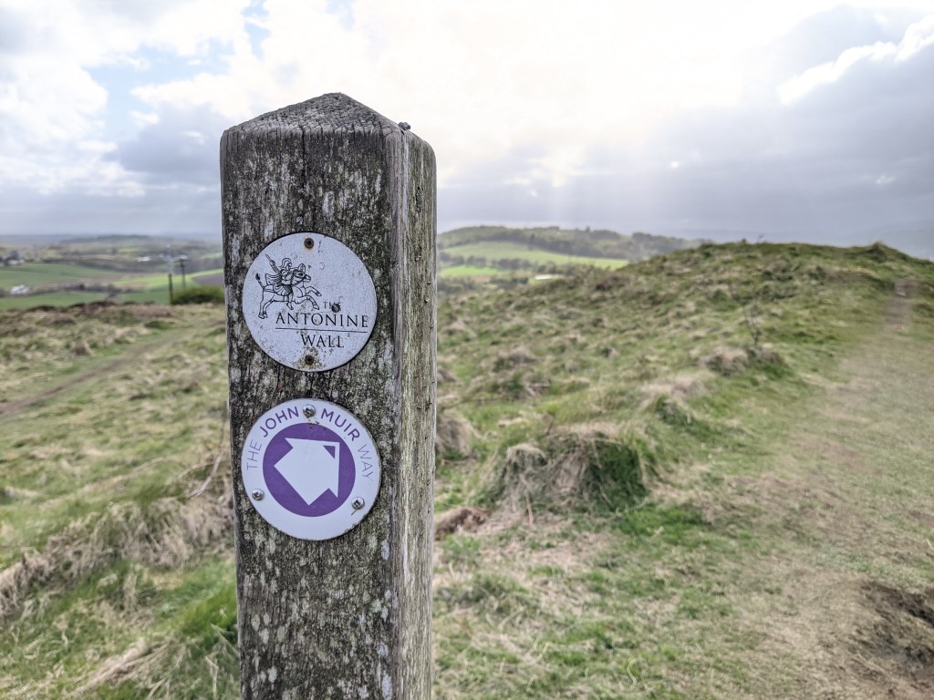
Many parts of the much-longer John Muir Way also visit Antonine Wall sites.
Here are some notable walking spots:
- Kinneil Estate, Bo’ness – Start your journey here with preserved Roman fortlet remains.
- Callendar Park, Falkirk – A stretch through beautiful woodland with ditches and ramparts.
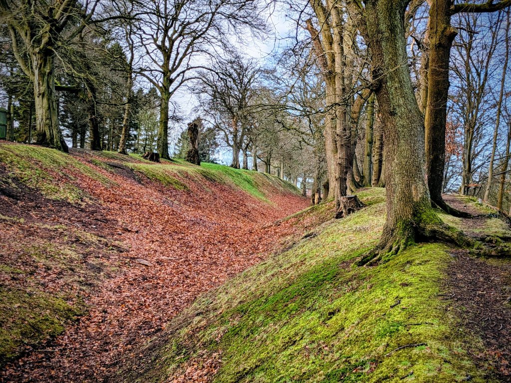
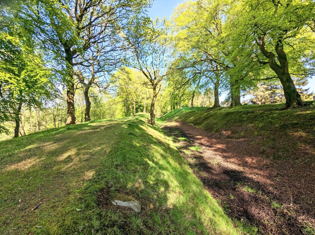
- Rough Castle Fort – The best-preserved Roman fort on the Wall. Park at the Falkirk Wheel and walk up to the site (pictured below).
- Croy Hill and Bar Hill Fort, near Auchinstarry Marina, by Kilsyth.
- Forth and Clyde Canal – the canal towpath links a number of important sites, including Old Kilpatrick (the end of the Wall) and Lambhill Stables (home of a modern Roman sculpture).
Public bodies and charities have produced guides to walks around the Antonine Wall:
- Discover the Antonine Wall (PDF, Falkirk Council)
- Antonine Wall and Forth and Clyde Canal (VisitLanarkshire)
- Antonine Wall Trail (John Muir Way)
- Antonine Wall Heritage Trail (West Dunbartonshire Council)
- Antonine Wall Community Map (West Dunbartonshire Council and partners)


Roman sites to visit along the Wall (east to west)
- Carriden Roman Fort site, Bo’ness
Did you know the Carriden area of Bo’ness was once called Velunia? The name was given to the local Roman fort, serving the Antonine Wall. It was located in what’s now an empty field, on land looking down on Carriden Beach and the John Muir Way. Check out our audio guide to the area. - Bridgeness Slab Replica, Bo’ness
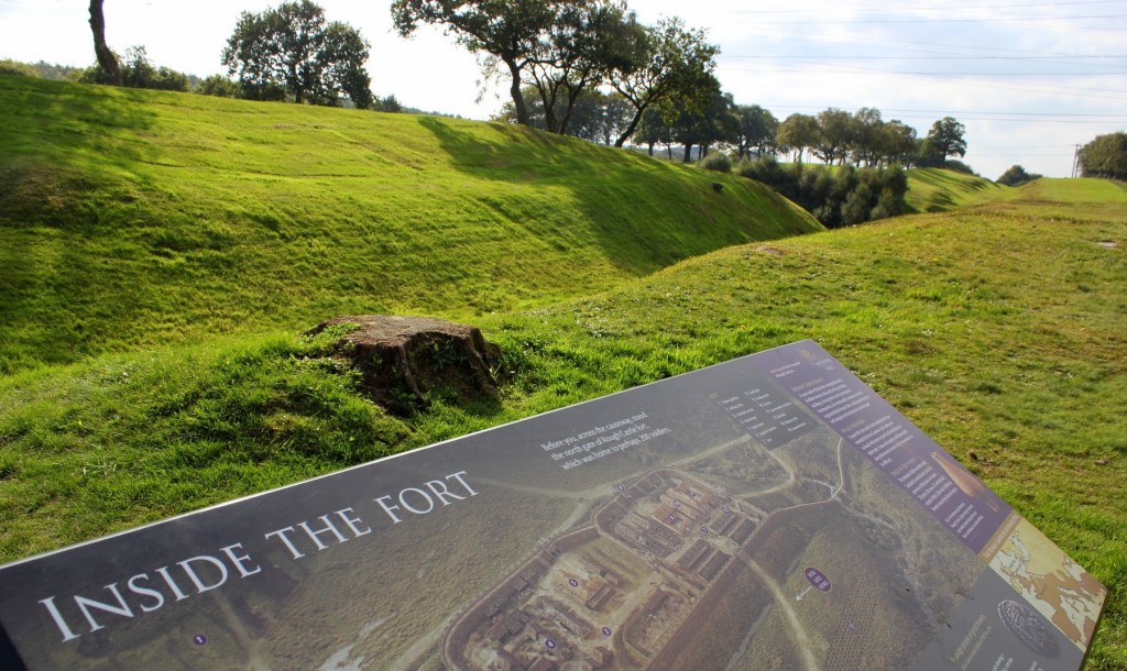
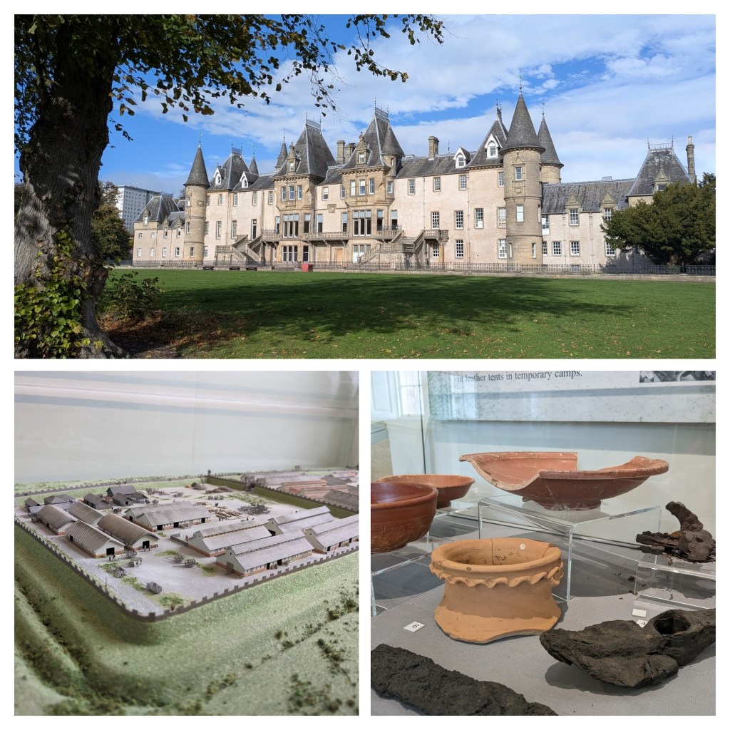
The slab marks the eastern end of the Wall. This replica was unveiled in 2012. The site also includes interpretation panels. Other replicas are also located along the line of the Wall. - Kinneil Museum and Estate, Bo’ness
Roman artefacts are on show in the museum. A short walk away are the remains of a Roman fortlet (pictured below). The site also boasts the impressive Kinneil House. - Callendar House Museum and Callendar Park, Falkirk
See long stretches of the Antonine Wall ditch and the excellent museum in Callendar House. - Watling Lodge, Falkirk
See the best-preserved section of the Antonine Wall ditch. A Roman fortlet was also located in this area. - Rough Castle
Rough Castle, a short walk from the modern Falkirk Wheel, is seen as the best-preserved fort site. There are extensive interpretation boards and a good section of the Antonine Wall ditch, as well as lilia defensive pits. - Seabegs Wood
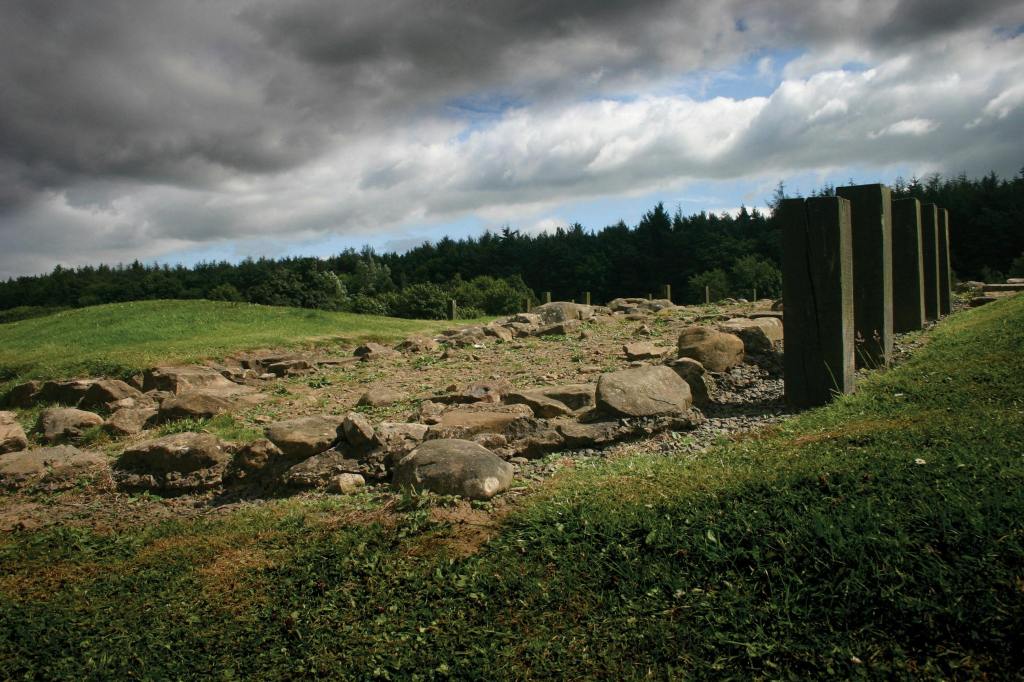
A short walk from Rough Castle. Offers good views of the Antonine Wall ditch and rampart, as well as the best-preserved visible remains of the Military Way. - Castlecary Roman Fort
At the edge of the Falkirk Council area, this site is one of two Roman forts on the Antonine Wall that featured stone ramparts. You can see portions of building above ground. - Croy Hill
Between Croy and Kilsyth. Was once home to a fort, a fortlet, a temporary camp, and two raised platforms, known as ‘expansions’, which may have been used for signalling. The site offers stunning views to the hills in the north. - Bar Hill
The highest fort on the Antonine Wall. You can see the remains of some Roman buildings. You can walk from Auchinstarry Marina. - Bearsden
You can see exposed and preserved remains of a Roman bath house here. - New Kilpatrick Cemetery, Bearsden
Two sections of the Wall’s stone foundation are preserved and visible in the cemetery.
More sites and attractions are highlighted on the Antonine Wall Trail.


Museums to visit (east to west)
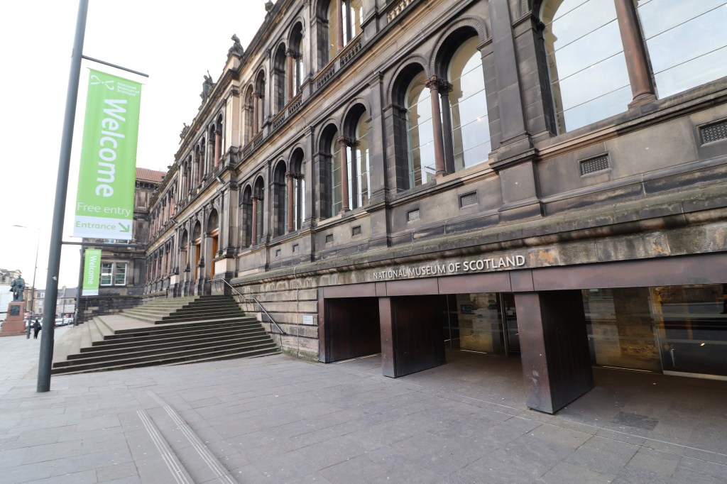
- National Museum of Scotland, Edinburgh
Features Roman coins from Falkirk, an altar from Carriden, Bo’ness, and the original Bridgeness Distance Slab from Bo’ness. - Kinneil Museum, Bo’ness (pictured)
Free-entry museum near the Antonine Wall’s eastern end. - Callendar House Museum, Falkirk
Features a permanent Antonine Wall exhibition. - The Auld Kirk Museum, Kirkintilloch
Small local museum with Roman finds and community history. - Hunterian Museum, Glasgow
Houses the UK’s best collection of Antonine Wall inscriptions and artefacts.
New Roman exhibition for 2026
The National Museum of Scotland in Edinburgh is hosting a new exhibition “Roman Scotland: Life on the Edge of Empire” from Saturday 14 November 2026 to Sunday 18 April 2027
Get details on the NMS website.


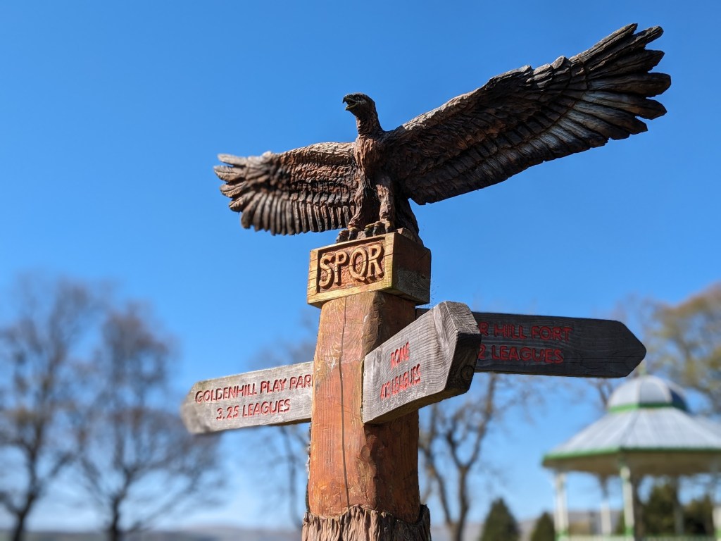
Public art / Sculptures
Public art along the Wall brings Roman stories to life.
The Roman Bridgeness Slab is the largest distance stone found along the Antonine Wall. An impressive replica is located off Harbour Road, Bo’ness. The postcode is EH51 9LF (Map)
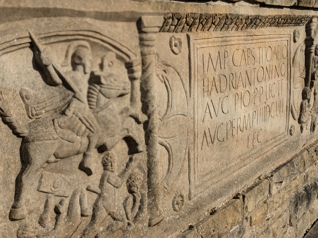
Since the sculpture (pictured above) was unveiled in 2012, other replica distance stones – showcasing original Roman art – have been unveiled along the line of the Antonine Wall. These are at:
- Nethercroy, near Auchinstarry Marina, by Kilsyth (Map)
- Beside the Healthy Living and Enterprise Centre at Twechar (Map)
- Lambhill Stables, Glasgow (pictured below) (Map)
- By the Forth and Clyde Canal at Old Kilpatrick (Map)

A modern distance stone has also been unveiled at Cow Wynd, Falkirk.
These are part of the Rediscovering the Antonine Wall initiative. See a map of the projects here.
The project also helped deliver:
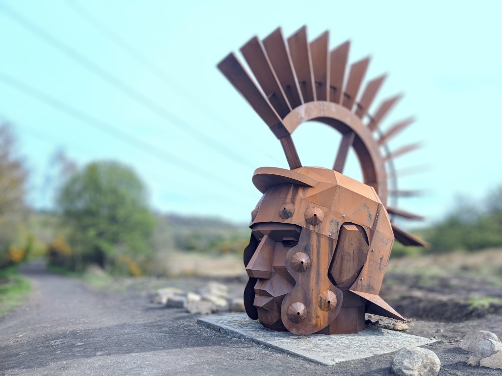
- The Kinneil Gate Guardian sculpture at Kinneil Estate, Bo’ness (based on a Roman harness)
- Bonnybridge Roman Heritage Plaque (beside the Community Centre)
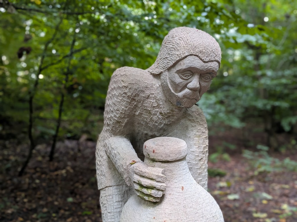
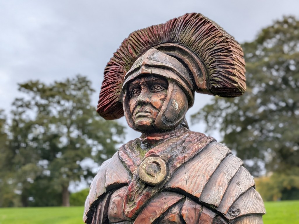
- Silvanus sculpture (pictured below), on Croy Hill (near Auchinstarry Marina)
- Cadder Fort Roman Bench (beside the Forth and Clyde Canal.)
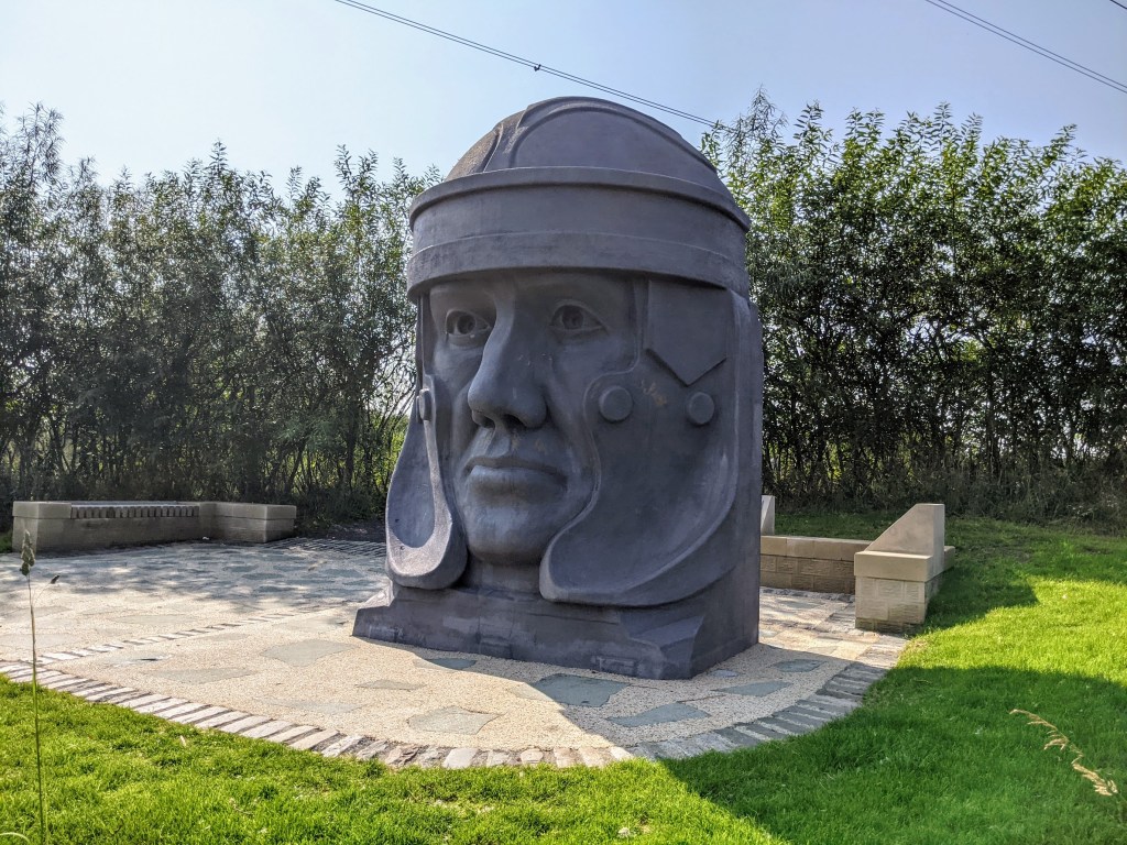
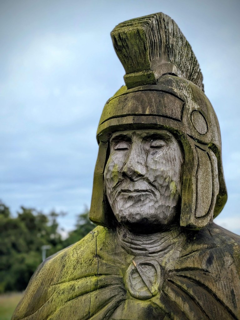
- Aurelius sculpture, Lambhill Stables, Glasgow
- Lusset Glen Bench and Sculpture, Old Kilpatrick, near Glasgow.


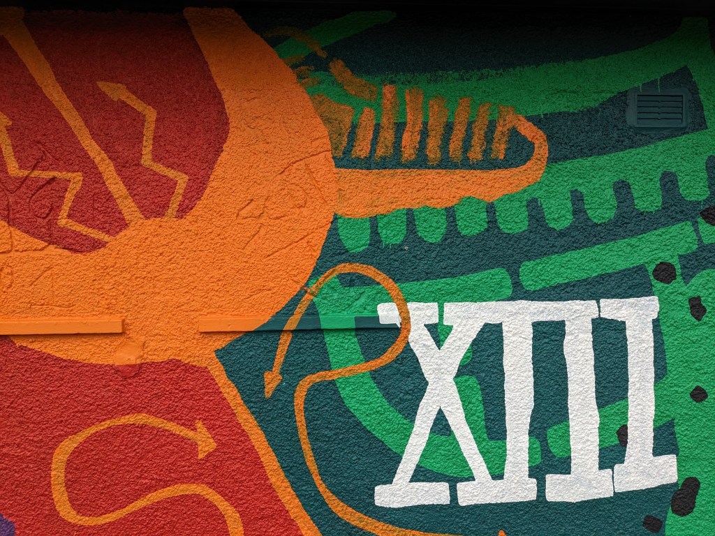
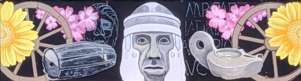
Roman-inspired murals and playparks
As part of the Rediscovering the Antonine Wall initiative, modern murals have been installed near the Antonine Wall, as well as play parks.
The murals are at:
- Douglas Park, Bo’ness (pictured below)
- Auchinstarry Marina, by Kilsyth
- Kirkintilloch
- Glasgow – Lambhill Stables (showing a soldier’s head, see below).
- Melfort Park, Clydebank
- Kirkintilloch
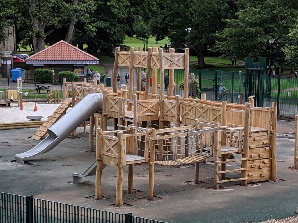
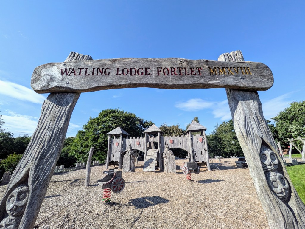
The play parks are located at:
- Callendar Park, Falkirk FK1 1YR (pictured below)
- Auchinstarry Roman Play Park, Kilsyth G65 0TD
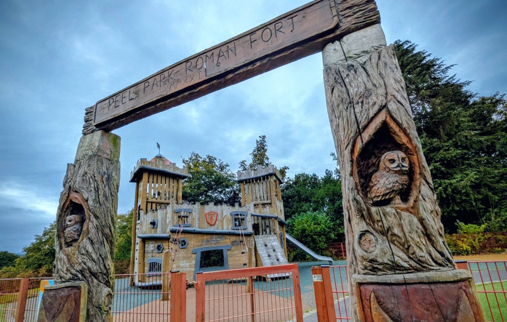
- Peel Park Roman Playground, Kirkintilloch G66 1AA
- Monymusk Place, Drumchapel G15 8JL
- Golden Hill Park Roman Play Area, Clydebank G81 6BU
There’s also an additional play park, funded by the National Lottery, beside a stretch of wall ditch at Watling Lodge, by Tamfourhill in Falkirk. The postcode is FK1 4SD
A new Roman play park is also being delivered at Kinneil Estate, Bo’ness. The postcode is EH51 0PR. The site is expected to be ready later in 2026.
Read the Falkirk Council press release.

Tourist attractions near the Wall
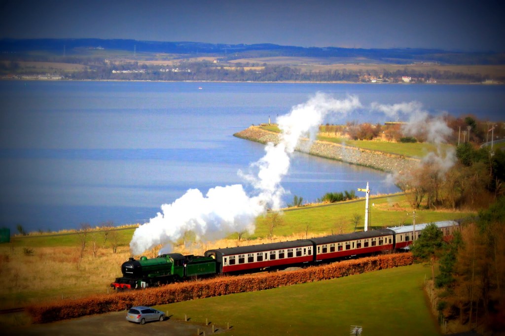
- Bo’ness and Kinneil Railway (pictured below)
- Historic Hippodrome Cinema, Bo’ness
- Kinneil House, Estate, and Museum, Bo’ness
- Callendar House, Falkirk
- The Helix Park and the Kelpies, Falkirk/Grangemouth (pictured below)
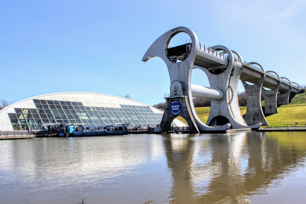
- The Falkirk Wheel
- The Forth and Clyde Canal
- The John Muir Way
- Auchinstarry Marina, by Kilsyth


Antonine Wall videos
Videos produced by the Rediscovering the Antonine Wall project. (The project has now ended and some online materials are offline. However the Antonine Wall YouTube channel is still available.)
Also check out “The Secrets Of Antonine Wall: The Sequel To Hadrians Wall” on the Our History YouTube Channel, delivered by ITV Studios.
Fancy discovering the Roman Antonine Wall in Scotland?
Kinneil Roman fortlet and nearby museum, on the outskirts of Bo’ness, are good places to start.
Watch this video to find out more.
You’ll also find lots of information on the Kinneil website at www.kinneil.org.uk

Podcasts / audio
- Antonine Wall – the Ancients
- The Scottish History Podcast – the Antonine Wall
- Love Scotland Podcast – The Antonine Wall
- BBC Scotland Outdoors – Ospreys, Antonine Wall and Wild Diet
- Edinburgh Outdoors – Antonine Wall – finding the Romans
- Edinburgh Outdoors – Kinneil Estate: from Romans to racing drivers
- How and Why History: The Birth of Scotland
We asked Google’s Notebook LM tool to use AI to create a podcast about the Antonine Wall and some of the information in this web page. Listen here. It’s a great guide (although the American pronunciation of some place names is a little dodgy!).

Maps
- Antonine Wall map, showing forts and fortlets
- Rediscovering the Antonine Wall project map
- Antonine Wall sites on Google Maps (Hunterian)
- Antonine Trail map
- Romans in Scotland maps

Connect with us
Bo’net is keen to explore ways to promote our Roman and wider heritage.
We’ve organised events, talks and guided tours and supported outreach work with Hadrian’s Wall in northern England.
If you’d like to support our efforts, please get in touch. Likewise, if you find broken links on this page – or want to make suggestions for additional content – please reach out.
Contact our Secretary, Adrian Mahoney. Full details here.
All images and some text by Adrian Mahoney